Prepare To Catch Fish With Omnia PRO
Lake-based intel and shopping benefits for the serious angler
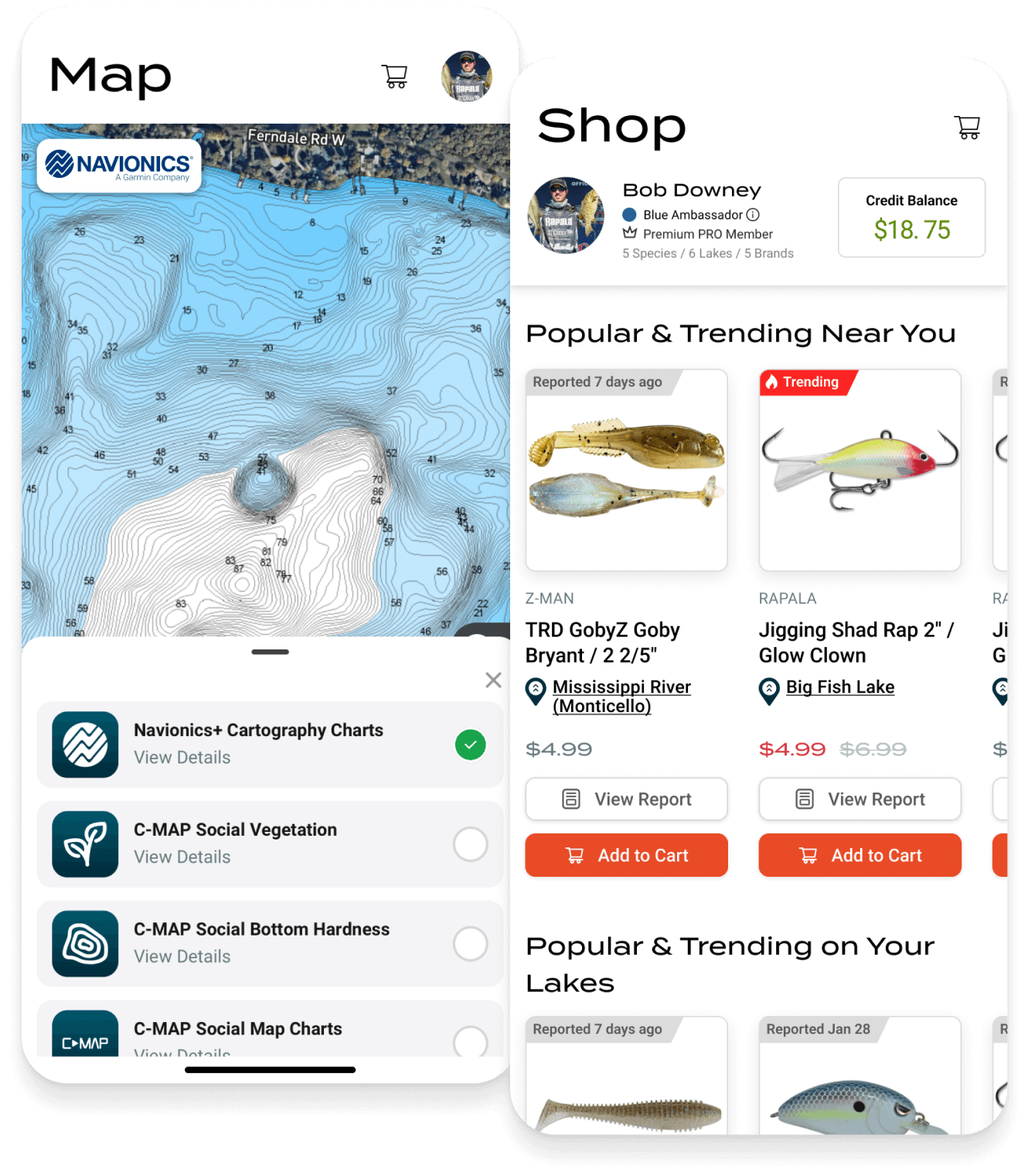
Get all the info and gear you need to be prepared for a great day on your lake. Access lake structure details, current water conditions, wind and weather for thousands of lakes and enjoy free shipping and 10% credit back on all your gear purchases.
Go To The Water Prepared
All the lake info, local angler reports and current conditions you need to eliminate dead water before you even arrive.
Omnia PRO Membership Benefits
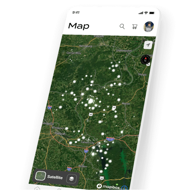
Omnia PRO was made with serious anglers in mind. Members earn 10% back and free shipping on each of their gear purchases. Plus they can use the Omnia Fishing app to access map layers with crucial fishing info that you can use in combination. Most layers are also available from the web.- Detailed lake info including depth contours, bottom composition, water clarity and water temp.
- Critical weather info on wind, cloud cover and barometric pressure.
- Safety considerations through radar, storm cells and lightning strike data.
- Plus, 10% back on gear purchases and free, fast shipping from our warehouse.
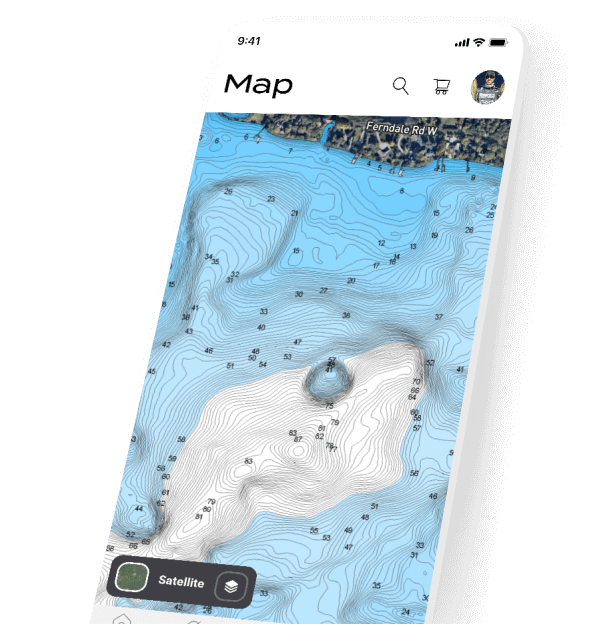

Depth Contours
Use info from Navionics and C-MAP for detailed, accurate depth information. No separate Navionics subscription required.

Bottom Composition
Understand your waterbody's hard and soft transition zones.
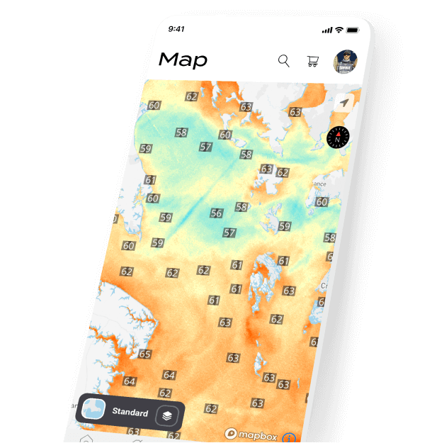

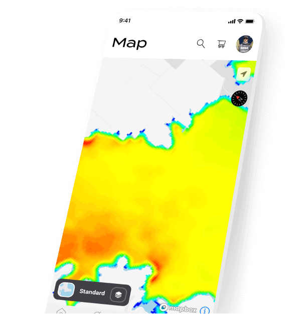
Water Temperature
Current surface temps to show warming and cooling spots.

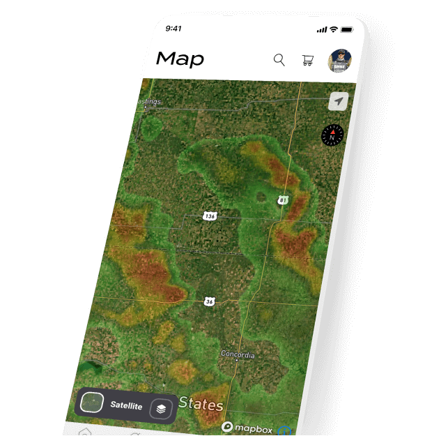
Water Clarity
Identify the clear and murky water and adapt your approach.
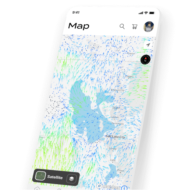

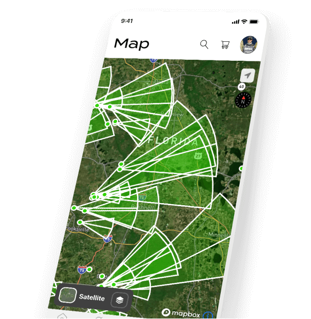
Wind
Granular data on the strength and direction the wind is moving.

Weather Radar
Stay safe by staying aware of incoming weather.

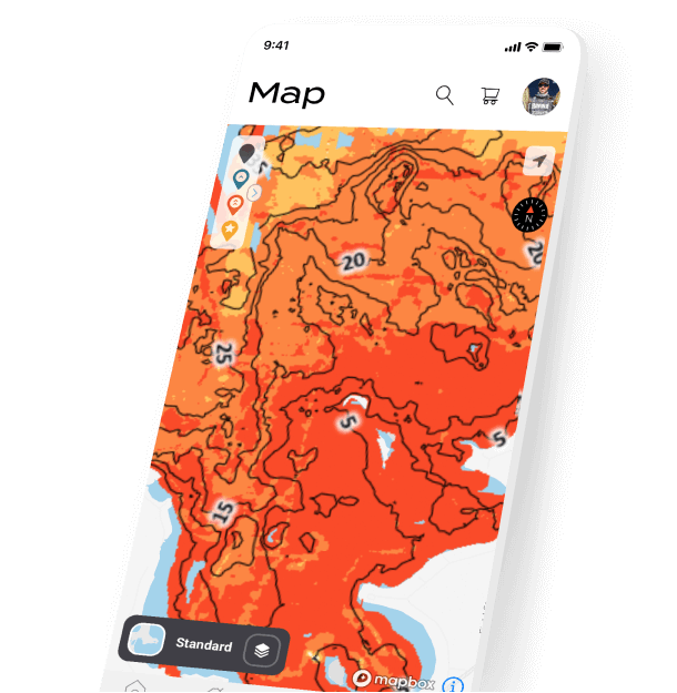
Air Temperature
Incorporate air temperature when deciding on fishing locations and timings.

Lightning Strikes
Recently recorded strikes are presented at their location on the map.

Storm Cells
Ensure safety by being conscious of approaching weather conditions.
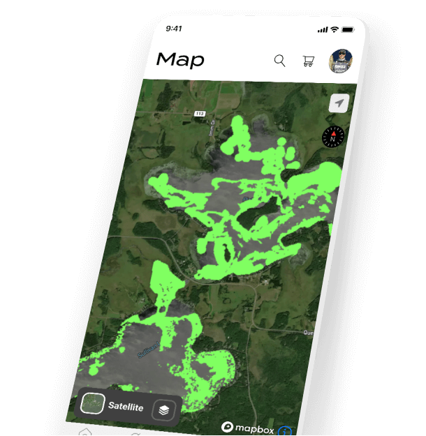

Vegetation
Use the submerged vegetation layer to target weed lines and tailor your presentations.
“Water temperature is a key data point for making a decision on predicting fish patterns, helping me choose techniques and informing my strategy for catching big bass. These Omnia maps are a game changer!”
Patrick Walters
“This technology will cut down on precious practice hours for tournament anglers and allow casual anglers to make the most out of the time they have to catch fish.”
Ricky Harris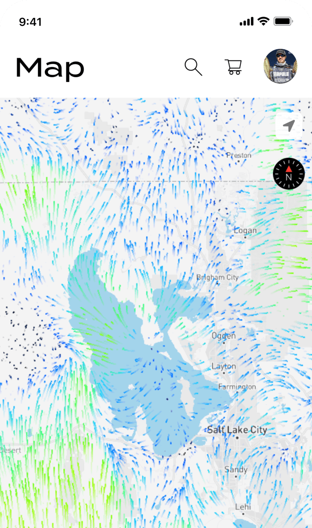
Download the FREE Omnia Fishing app to get started.


Or already have the app?
Using PRO Maps To Catch More Fish
Frequently Asked Questions
Are all lakes in the United States covered?
Our map layers and weather data coverage varies, but is not comprehensive. Our goal is to cover most of the major recreational fisheries in the United States. Contours and Water Clarity data is available on over 30,000 lakes. Water Temperature data is available for around 8,000 lakes. Weather data is available for all waterbodies in the United States. Omnia is continuously adding more lakes and expanding our available dataset.
Can I check if my favorite lakes are available?
Omnia offers a FREE 7-day trial. During this trial, you can use all of the available Omnia PRO features to test out the map layers and confirm coverage in your area.
How frequently is the data updated?
The map layers and weather data are collected from several different sources so the frequency varies. Water Temperature data is usually refreshed every 1-5 days depending on satellite passes and visual obstructions like cloud cover. Water Clarity data is currently updated on a monthly basis showing the average readings for the current month based upon a multi-year average of historical data. Contour data from Navionics is updated many times per day. C-MAP's community-collected readings are automatically added to PRO within 1 day.
How is this information collected?
Data collection sources vary. Water Temperature and Water Clarity data is derived from satellite-based sources and compiled to present an accurate heatmap layer for each lake. Detailed nautical charts are provided through Garmin Navionics. C-MAP Genesis layers provide further detail on contours, bottom composition and vegetation based upon on-boat sonar/GPS readings made by a community of anglers on lakes across the United States.
How accurate is the data?
Observations show a close comparison between real-world data readings and the Omnia PRO map layer information in our heatmaps. But the data is most useful as a way to identify the relative values for a lake and should not be considered perfectly accurate or in real-time.
How can anglers use current lake conditions info?
There are many applications for using the Omnia PRO data to make decisions while on the water. For example, using Water Temperature to locate the warming areas of the lake during the spring spawning season, find cool underwater springs during summer months or selecting a lake for an outing based on the current water conditions being favorable. Other use cases include choosing the right bait colors based upon clarity estimates, monitoring weather conditions for a safe trip and using current wind readings to select the best launching points on a waterbody.
Is historical data available?
Generally, the map layers and weather data reflects estimated current conditions. Historical or forecasted data is not currently available, but will be added to the Omnia PRO membership in the near future.
Is Omnia PRO available on the Omnia website?
PRO members can access lake and shopping benefits from the web as well as the Omnia Fishing app. Some map layers, such as Navionics, are currently only available from within the app.
How do I get a refund for my purchase?
Please contact support to learn how to request a refund for a purchased subscription.