
Download FREEx100k Downloads
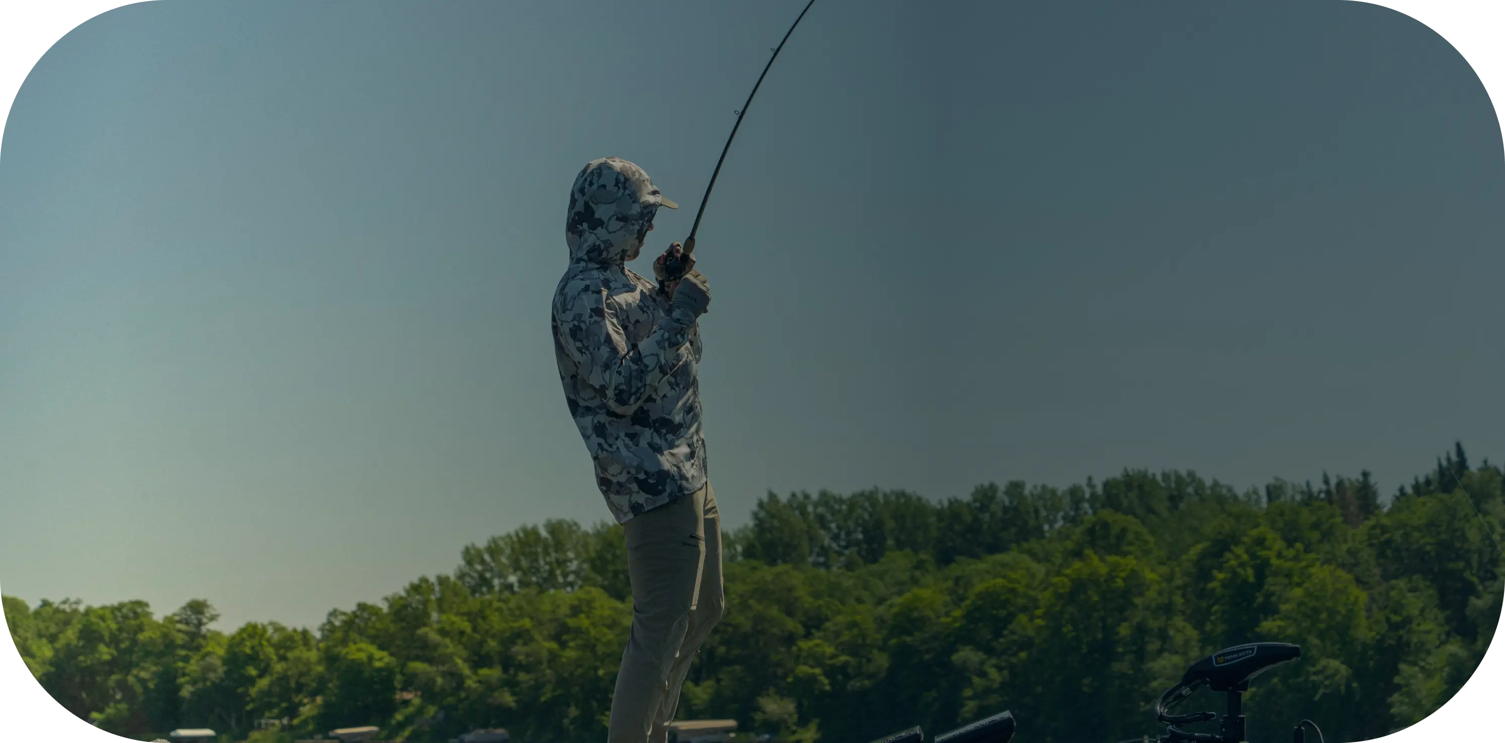
Find Fish-Rich Water. Trending Tackle. And Free Local Fishing Reports


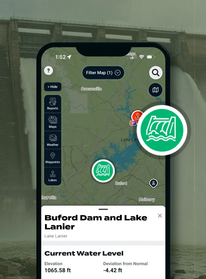
Water Level Stations
Track rising or falling water to predict fish position shifts.
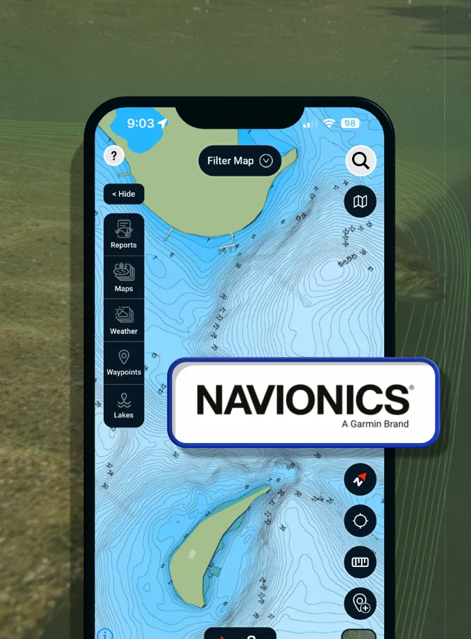
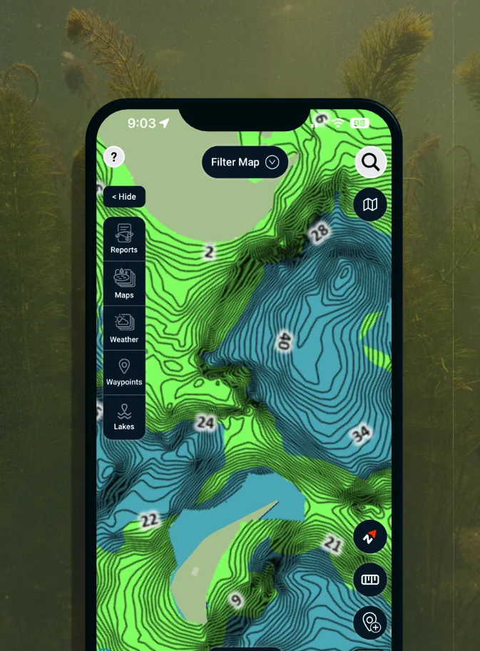
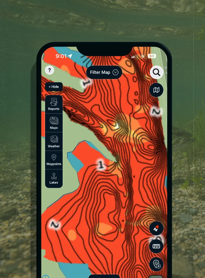
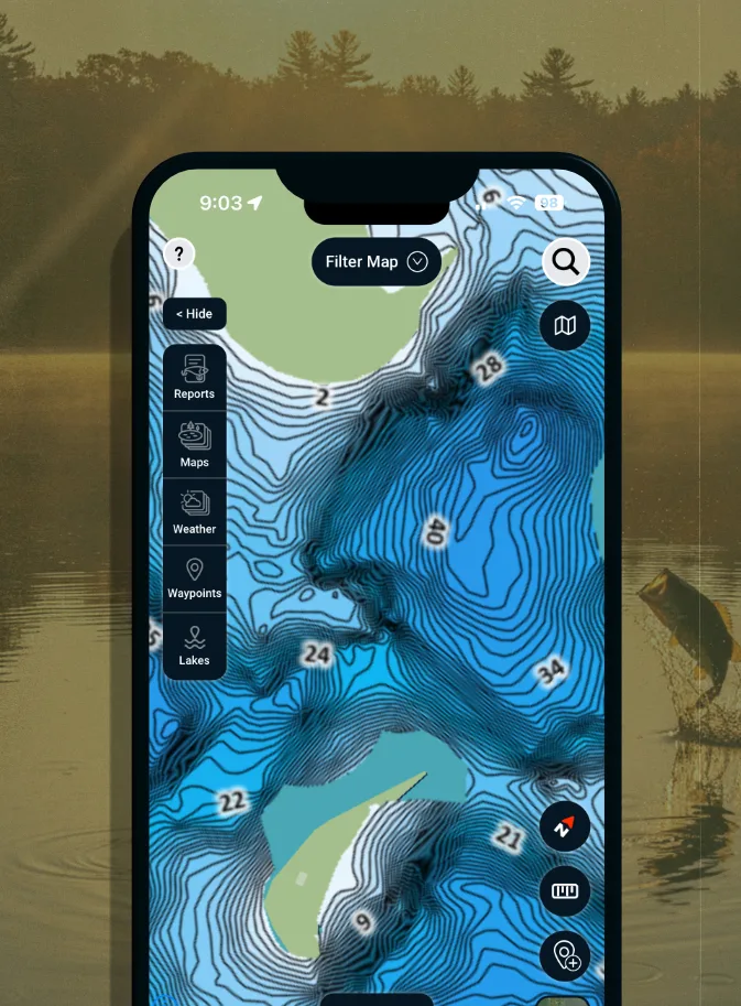
Navionics® HD Depth Charts
Dial in structure, breaks, and depth changes with precision contours.
C-MAP Social Vegetation
Find grass lines and cover where fish feed and hide.
High Res Historical Water Temp
Track seasonal patterns to stay on fish year-round.
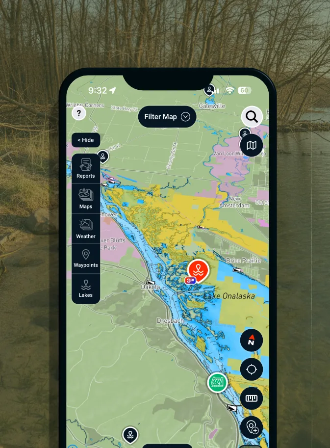
Public Land Boundaries
Stay on the right side of the line and in the right spots.
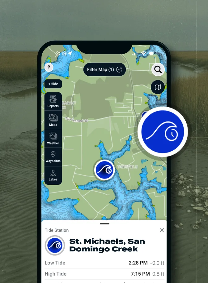
Tide Stations
Fish the right tide at the right time and stay on active water.
C-MAP Social Bottom Hardness
Identify hard vs soft bottom to locate high-percentage areas.
C-MAP Social Map Charts
Combine structure and activity data to fish smarter, faster.
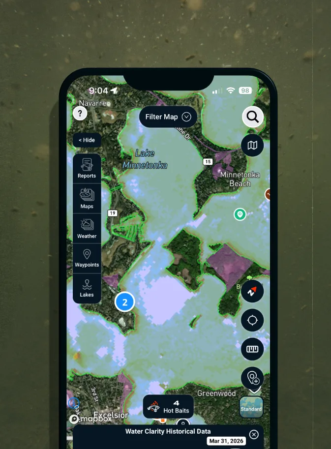
Water Clarity
Match bait and location to visibility for more bites.
Wind Direction
Position yourself where wind pushes bait and activates fish.
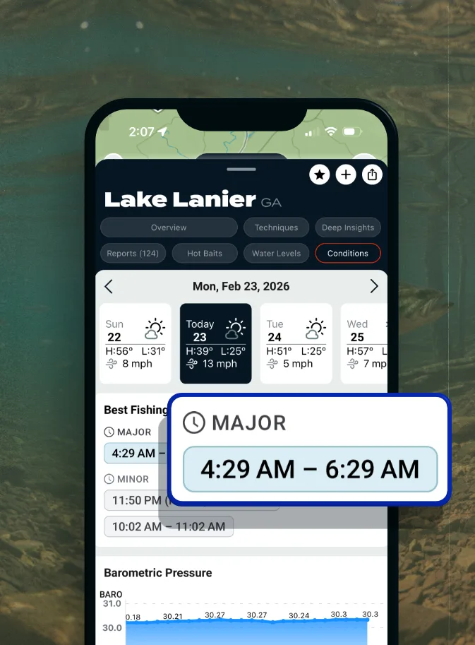
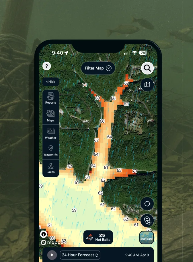
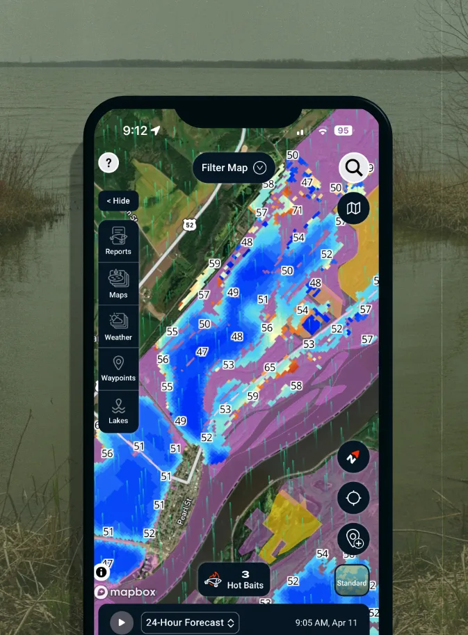
Best Fishing Times
Plan your trip around peak feeding windows, not guesswork.
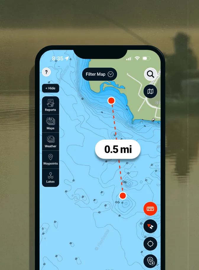
Measurement Tool
Quickly measure distance between spots to plan casts, drifts, and routes.
I love the ease of use and all the different features from contour lines to water clarity.
- Jason S.
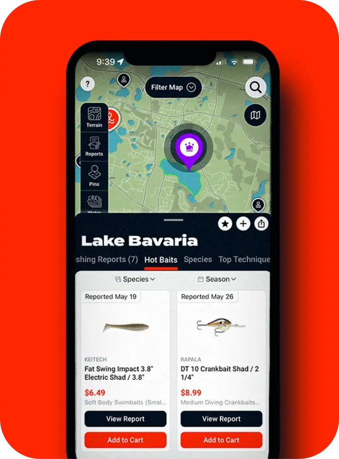
Hit the water with the perfect plan and tackle.
Tap the lake pin, see trending tackle and techniques, and have baits delivered to you quickly. We narrow over 25k items to the best match on each lake.
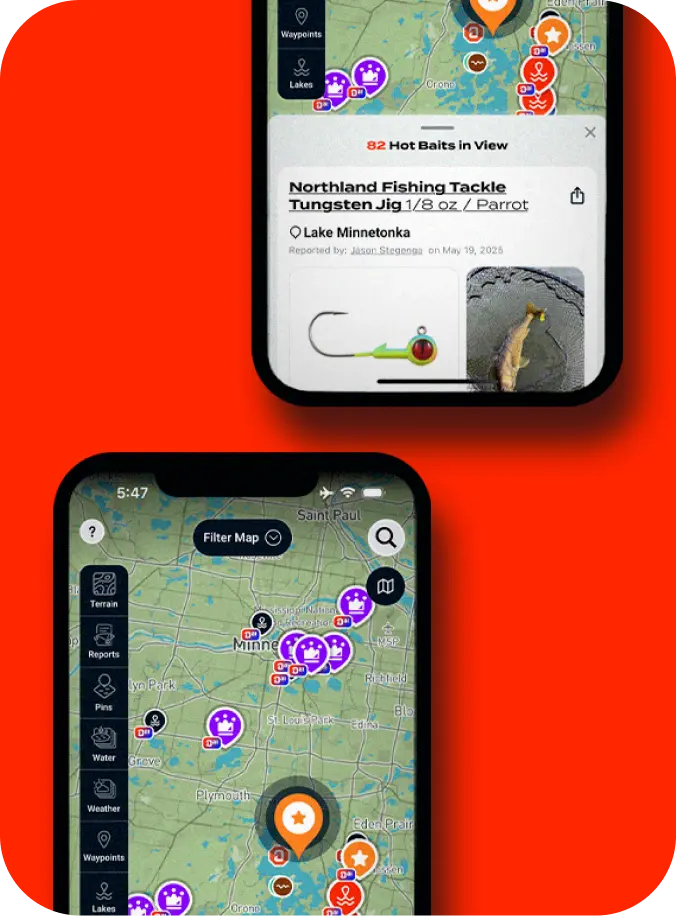
Free Local Fishing Reports
Real reports from real anglers. Tap a lake, get the latest on what’s biting, where, and why. Pull from over 30,000+ verified fishing reports—and counting.
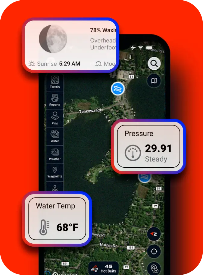
Scout Smarter with Real-Time Lake Intel
Then layer in lake-wide water temperature, barometric pressure, and moon phase to understand when fish are most likely to feed—and where they’ll show up.
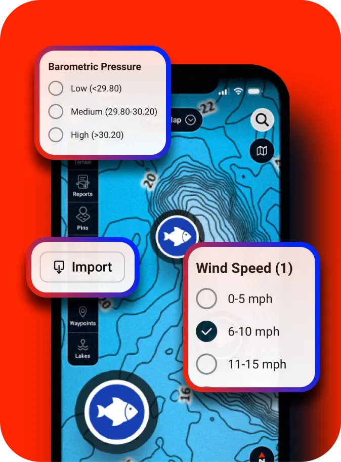
Waypoint Management: Create, Import and Pattern Like a Pro.
Drop pins. Import old ones. Then filter by wind, pressure, moon phase, or season to build out what’s working—and when. Syncs across mobile, desktop, and tablet.
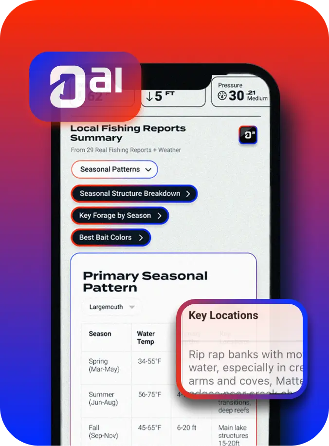
Find Structure with AI-Fueled Fishing Reports Summaries
Season, depth, species, and more—crunched into a simple plan so you don’t waste time guessing.
Wanna get really smart about your lakes with the right plan?
Unlock Deeper Maps and Rewards
Try Omnia PRO for FREE
- Today: Start your free 7-day trial
- Day 5: Get a trial reminder
- Day 7: You’ll be charged $59/year
Your Benefits
Free
Core
PRO
- Free shippingOver $99 Over $25No minimums
- Shop 25,000+ Tackle and Gear, Available by Lake
- Depth contours from Navionics® HD Depth Charts
- Depth contours from C-MAP®
- Cash Back Rewards5%10%
- Detailed Water Temp Coverage
- Water Clarity
- Current Wind Speed and Direction
- Public & Restricted Land Access Maps
- C-MAP® Bottom Composition
- C-MAP® Vegetation
- Water Level Stations
- Current and Forecasted Air Temp, Precip, Storm Cells
- Read 30,000+ Fishing Reports
Cancel anytime. No charge before Day 7.
Reviews
Tough Tests, Real Results
Best service for fishing tackle. Fast and free shipping every time. I love the maps for planning my next trip and checking recent angler reports.
Larry Koch
Between the detailed maps and the ability to see exactly what to look for in a lake, Omnia is all you need for fishing success. Super‑fast shipping seals the deal.
Joseph Doherty
Everything a fisherman needs in one app! I use the Pro maps every trip to find the right spots and get free shipping with my membership.
Rob “Arksis” Rivera
Quality, accurate maps for every body of water I’ve fished. Love being able to mark the spots where I’ve actually caught fish.
Seanybean
Love the Omnia app. The map overlays—especially Navionics and real‑time water temp—are game‑changers, and free fast shipping on tackle is huge.
LoganAndera
The Omnia app lets me shop and see map layers in one place. Premium membership adds water temp, wind speed, clarity, and more—super helpful for planning.
pointfishing
Originally downloaded for a promo, but I’m renewing because the charts are incredibly detailed and have helped me catch way more fish.
bugscuffle
I fish a lot, so the points that give me free products and the unlimited fast shipping—plus Pro‑only deals—are an unbeatable combo.
DollaBillGill
I’ve used Omnia Fishing Maps & Tackle for several years—it’s grown into much more than a tackle‑shopping app; it’s essential for every trip.
Nullthreat
Always super‑fast shipping. Premium membership means free unlimited shipping plus 10% back in credits for future purchases—no brainer.
JJacobs88
And Field Tested by PROs
Seth Feider, Breaks Down Leech Lake with Omnia PRO
Seth Feider
Bassmaster Elite Series Pro
Get Started
Try 7 days for FREE
100k+ Downloads