
C-MAP 101: Read the Water. Find the Fish. Fast.
You’ve got the gear. You’ve got the boat. But maps, good ones, can make all the difference. That’s where C-MAP® comes in. It’s a set of layers: contours, bottom hardness, and vegetation. They let you see what’s under the water. Not guesses. Real underwater structure. Real cover. Real chance to catch more fish.
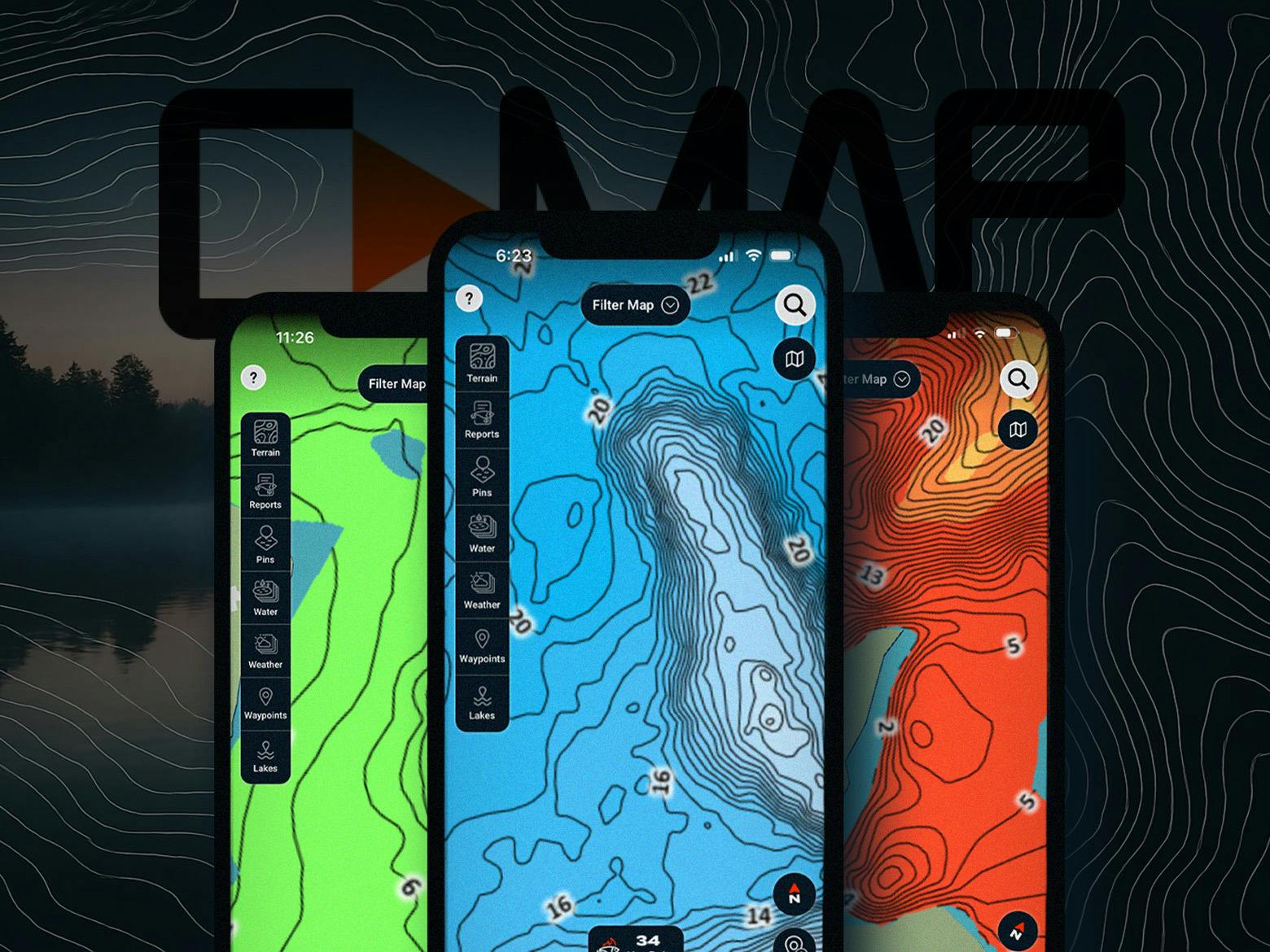
What is C-MAP, Anyway?
C-MAP is built for anglers. It mixes sonar and GPS data from boats out on the water with community-shared info to build detailed maps. That means:
- • 1 foot contour lines for precise depth.
- • Bottom detail showing whether the lake floor is hard rock, gravel, or soft muck.
- • Vegetation layers that highlight weed beds, edges, and open pockets.
Why that matters: Social data keeps these maps alive and fresh. Anglers add detail every season, so you’re looking at real information gathered from real time on the water.
Three Must Know Layers and How to Use Them
These layers are the bread and butter of C-MAP®. Think of them like tools in your tackle box. Each one shows a different piece of the underwater puzzle. Put them together, and you’ll spend less time guessing and more time catching.
1. Contour Lines (Depth Contours)

Contour lines connect points of equal depth. They turn a flat blue lake into a story you can actually read.
- • Shallow Water: Light blue areas show 1–8 feet. Often shoreline or shelves.
- • Drop-Offs / Steep Slopes: Tight lines packed together. A quick change from 8 feet to 20, then down to 34. Fish love these edges.
- • Deep Water Basins: Darker blue zones. Think 36–42 feet. Often channels or the main basin.
- • Points and Ridges: Where lines jut outward or inward. Submerged features that concentrate fish.
- • Flats: Lines spread wide apart. Consistent depth over a large area. Great feeding grounds.
- • Shoreline: Green or gray along the edge. Your starting reference point.
Why it matters: Fish follow depth changes. Contours show you travel routes, feeding shelves, and ambush spots.
2. Bottom Hardness

Turn on bottom hardness, and the picture changes. Now you’re seeing what the lake floor is made of.
- • Red / Orange: Hard bottom. Rock, gravel, compacted sand.
- • Yellow / Light: Soft bottom. Mud, muck, or silt.
- • Hard Bottoms: Structure, ambush cover, spawning sites.
- • Soft Bottoms: Can hold forage like worms, insects, or areas of vegetation.
- • Transitions: The money zone. Where hard meets soft, fish stack up.
Why it matters: Different fish prefer different bottom types. Hard bottom = more structure and spawning. Soft bottom = food and vegetation. Combine this with contours, and you’ll see both depth and composition in one glance.
3. Vegetation

Add vegetation, and the underwater map turns into a living forest.
- • Green Areas: Underwater plants like weeds, hydrilla, or grass.
- • Blue Areas: Open water without cover.
- • Cover and Ambush: Fish hide in weed beds and dart out to strike.
- • Food Source: Bugs, invertebrates, and baitfish live in the weeds. Bigger fish follow.
- • Shade and Oxygen: Weeds provide cooler, oxygen-rich water in the summer.
- • Spawning Grounds: Some fish species lay eggs in vegetation.
- • Edges and Holes: Look where green meets blue. Weed edges and pockets are prime spots.
Why it matters: Vegetation is food, cover, and comfort all in one. Combine it with contours and hardness, and you’ll find the sweet spots fish can’t resist.
Take a few minutes to study the map. Spot the contours. Find the hard-to-soft transitions. Trace the weed edges. Then get on the water. Try it out.
Fewer wrong turns. More right ones. More fish in the boat.
Tight lines,
The Omnia Team