
Is Omnia’s Water Temperature Layer Accurate? Understanding Historical Lake Temperature Insights
Anglers often ask, “Is Omnia’s water temperature layer accurate?” The short answer is: Yes—but it’s most accurate as a historical view of lake temperature trends rather than exact, real-time readings. Understanding how water warms and cools across a lake is essential for planning successful fishing trips, especially during seasonal transitions.
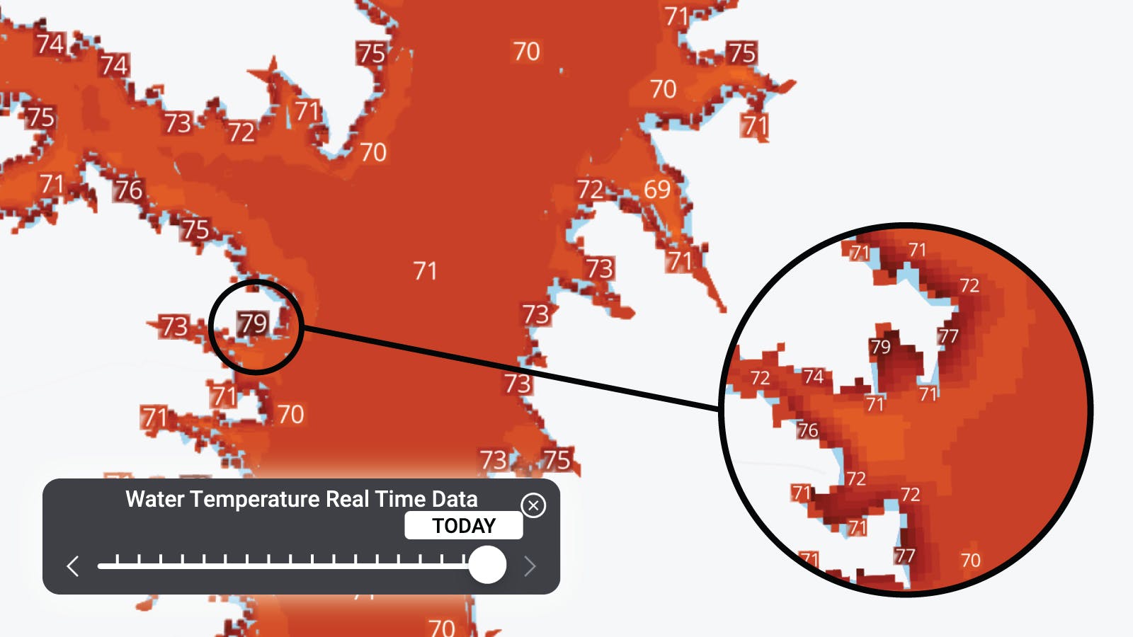
How Omnia’s Water Temperature Layer Works
Omnia displays lake temperature data over 30 days or more, as often as it can be sampled with satellites, creating a dynamic picture of how water behaves across the lake. Instead of providing a single “snapshot” of the current temperature, the layer shows historical warming and cooling trends, helping anglers identify:
- • Areas of the lake that warm or cool faster
- • Likely locations for feeding fish based on temperature shifts
- • Seasonal patterns in shallow versus deep water
Since there’s a historical view of water temps on each lake, this perspective is crucial because fish respond to temperature changes over time, not just the temperature at a single moment.
Why Historical Accuracy Matters
Water temperature can vary widely across a lake due to depth, shading, inflows, wind, and vegetation. While satellites and sensors can estimate surface temperatures, they have limitations for exact readings on every day:
- • Satellites that carry this sensing technology only pass over a location roughly every 8 days
- • Cloud cover can block readings, resulting in gaps in real-time data and then you’re waiting another 8 days.
- • Surface temperature alone does not reflect subsurface conditions, where many fish are actually holding.
Omnia’s approach compensates for these limitations by using aggregated historical data to give a reliable view of how different areas of a lake respond to temperature changes over time. This allows anglers to focus on trends rather than expecting pinpoint real-time accuracy.
How Anglers Use Historical Temperature Patterns
By analyzing historical temperature data, you can:
- Identify Hotspots and Cold Zones:
Areas that warm or cool faster often attract baitfish and predators and prespawn and spawning fish (spring). Historical trends show these zones consistently over weeks so you can identify where to expect the fastest warming or cooling water. - Plan Seasonal Transitions Across Multiple Patterns and Fishing Techniques:
Knowing how shallow bays, inlets, and points warm relative to the rest of the lake helps anglers anticipate fish movement during spring and fall transitions. This is why water temperature layers should always be matched against high quality contour data like Navionics™ and C-Map™
Lakes rarely warm uniformly, so different sections may be in pre-spawn, spawn, or post-spawn patterns simultaneously. For example:
- • One shallow bay may have fish still preparing for spawning (pre-spawn)
- • Another area may be full of spawning activity (spawn)
- • A deeper section may already have fish moving to post-spawn patterns
Omnia’s reports provide techniques tailored to each lake and season, allowing anglers to target the right species in the right area with the appropriate method. Essentially, you could be fishing different techniques simultaneously across the same lake, based on localized temperature trends and historical patterns.
- Optimize Gear and Techniques:
Targeting zones with predictable temperature changes allows anglers to select the right lures, baits, and depths, maximizing efficiency.
The Limits of Real-Time Water Temperature Monitoring
While Omnia provides excellent historical insights, it’s important to understand the inherent limitations of monitoring water temperatures:
- • Single snapshots can be misleading: Temperatures vary by depth and location.
- • Satellite passes are infrequent: Every 8+ days, with coverage gaps from weather conditions.
- • Surface data only: Subsurface temperatures, where fish often reside, may differ from the surface.
Historical data helps mitigate these issues by showing trends over time rather than relying on isolated measurements.
Conclusion
Omnia’s lake water temperature layer is highly accurate for historical and trend analysis, showing anglers where water warms or cools fastest and revealing patterns that influence fish behavior. Sometimes you hit on the day the satellite passes and it’s near real-time, but this normally isn’t the case. While it’s not a substitute for real-time surface or subsurface sensors, its aggregated historical perspective provides a powerful tool for planning trips, locating fish, and understanding seasonal lake dynamics.
By using Omnia’s water temperature layer, anglers gain a strategic advantage—not through exact numbers, but through accurate insight into where fish are likely to be based on temperature trends over time.
📱 Download the Omnia Fishing app today to access historical water temperature layers, maps, and community-updated fishing reports for smarter, more successful trips.